Navareas

The Worldwide Navarea Warnings Specialist

The Worldwide Navarea Warnings Specialist

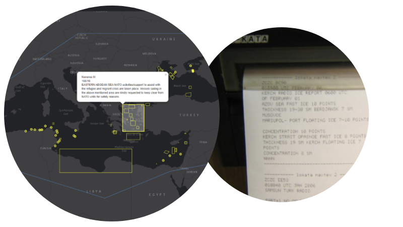
Released in 2019 as an extension to our Navarea warning app available on Android and Apple devices, Our Navarea warning API's are the one stop shop for nav area warnings, no more checking various websites for in-force and cancelled warning, use as a back up to your hardware receiver

We have advanced API's for our navarea warning dataset, perfect for integrating into your own systems and easy for developers to work with.

All warnings are checked and validated every 15 minutes so you never miss any data, all coastal warnings are included

Download on the App StoreDownload on Google Play
Navarea Warnings

LATEST NAVAREA WARNINGS: 6445

NavArea
Year
Message
USCG Southwest District 112026-01-09
06:17:00.63
The USMC 7th Engineer Support Battalion Explosive Ordnance Disposal (EOD)
Company, Echo Section, will be conducting underwater explosive training
operations at the Camp Pendleton Amphibious Vehicle Training Area. The scope of
operations includes the planned employment of underwater explosive charges not
to exceed 11 lbs Net Explosive Weight, in support of pre-deployment training
requirements. Operations are scheduled to take place from February 10, 2026,
through February 12, 2026. The exclusion zone for these operations is a
500-meter radius around coordinates 33.222146° N, -117.450680° W, based on the
maximum safe distance for the 11 lb charge being used at a depth not to exceed
60 feet. The Military Grid Reference System (MGRS) location is 11S MS 5800
7600. All mariners are advised to transit the area with caution and to remain
outside the established exclusion zone during the specified dates. Status :
Approved Type : Military Operations From : 2026-01-27 Until : 2026-02-13
Liaoning MSA2026-01-14
07:45:50.543
LIAOHAI NAVIGATIONAL WARNING 25/26, BOHAI, CANCEL LIAOHAI NAVIGATIONAL WARNING
522/25.
3rd RCG2026-01-14
07:35:24.227
GUNNERY 3RD RCG LOCAL WARNING NO.21. 141620 JST JAN. HONSHU SOUTH COAST,
SAGAMI WAN AND APPROACH,GUNNERY BY JCG PATROL CRAFT,CONCLUDED.CANCEL 3RD RCG
LOCAL WARNING NO.19.
Korea2026-01-14
03:00:20.397
1. This notice pertains to the Joint Chiefs of Staff Joint
Firepower Division-172 (2026. 01. 12.) 2. The Joint Chiefs of Staff informed
about the planned sea firing exercises as attached, so please inform navigation
and fishing vessels of the relevant details. * Details can be checked on the
navigational warning status board (https://www.khoa.go.kr/nwb).
Joint Chiefs of Staff Joint Firepower Division End. No. - Firing Zone - Date
- Time - Related Chart 1 - Korea Strait - South of Yokji Island (R-72) -
01/19,21,23 01/20,22 - 09:00 ~ 16:00 09:00 ~ 22:00 - 2200 2 - East Sea - North
of Pohang (R-74) - 01/19,20,21,22,23 - 08:00 ~ 18:00 - 1600 3 - Yellow Sea -
Southwest of Gyeokryeolbiyeol Islands (R-80) - 01/19,20,21,22,23 - 08:00 ~ 22:00
- 3011 4 - Yellow Sea - West of Imjado Island (R-84) - 01/19,20,21,22,23 - 08:00
~ 22:00 - 2011 5 - Yellow Sea - Northwest of Gyeokryeolbiyeol Islands (R-88) -
01/19,20,21,22,23 - 08:00 ~ 22:00 - 3011 6 - West Coast - Daecheon E (R-97E) -
01/19,20,21,22,23 - 09:00 ~ 18:00 - 3100 7 - Korea Strait - Southeast coast of
Geoje Island (R-99) - 01/19,20,21,22,23 - 08:00 ~ 18:00 - 2200 8 - South Coast -
Near Namhyungje Island (R-100) - 01/19,20,22 - 13:00 ~ 15:00 - 2112 9 - West
Coast - Near Miyeo Island (R-104) - 01/19,20,21,22,23 - 09:00 ~ 21:00 - 3411 10
- West Coast - Near Jik Island (R-105) - 01/19,20,21,22,23 - 08:00 ~ 22:00 -
3412 11 - East Sea - Far off Gangneung (R-107) - 01/19,20,21,22,23 - 08:00 ~
22:00 - 1700 12 - West Coast - Anheung 2 (R-108B) - 01/19,20,21,22,23 - 08:00 ~
19:00 - 3413 13 - West Coast - Anheung 4 (R-108D) - 01/19,20,21,22,23 - 08:00 ~
19:00 - 3100 14 - West Coast - Anheung 5 (R-108E) - 01/19,20,21,22,23 - 08:00 ~
19:00 - 3413 15 - West Coast - Anheung 6 (R-108F) - 01/19,20,21,22,23 - 08:00 ~
19:00 - 3100 16 - East Sea - South of Ulleungdo Island (R-115) - 01/19,22 -
14:00 ~ 16:00 - 1700 17 - West Coast - Near Daecheong Island Gapjuk (R-116) -
01/20 - 18:00 ~ 21:00 - 3714 18 - Korea Strait - East of Jeju Island (R-118) -
01/24,25 - 15:00 ~ 19:00 - 2400 19 - East Sea - Near Ulsan (R-119) - 01/19,21,23
01/20,22 - 09:00 ~ 16:00 09:00 ~ 22:00 - 1600 20 - East Sea - Far off Northeast
of Pohang (R-120) - 01/19 01/20 01/21 - 12:00 ~ 14:00 12:00 ~ 17:00 13:00 ~
15:00 - 1013 21 - Yellow Sea - Northwest of Anmado Island (R-123) -
01/19,20,21,22,23 - 08:00 ~ 18:00 - 3011 22 - West Coast - Near Gadeokdo Island
(R-124) - 01/19,20,21,22,23,24 - 08:00 ~ 18:00 - 3200 23 - Yellow Sea -
Northwest of Jeju Island (R-126) - 01/19,20 - 12:00 ~ 17:00 - 2300 24 - Korea
Strait - Near Seogwipo (R-128) - 01/19,22 - 09:00 ~ 12:00 - 2400 25 - West Coast
- Southwest coast of Baengnyeongdo Island (R-131) - 01/19,21 01/20,22 - 17:00 ~
19:00 14:00 ~ 20:00 - 3011 26 - West Coast - Southeast coast of Baengnyeongdo
Island (R-132) - 01/21,22 - 18:00 ~ 22:00 - 3714 27 - West Coast - Near Chochi
Am (R-133) - 01/19,20,21,22,23 - 08:00 ~ 18:00 - 3415 28 - East Sea - Near
Gangneung (R-135) - 01/19 - 09:00 ~ 12:00 - 1500 29 - West Coast - Coast of Wudo
(R-137) - 01/20 - 17:00 ~ 20:00 - 3711 30 - West Coast - West of Daecheongdo
Island (R-153) - 01/24 - 14:00 ~ 17:00 - 3011 31 - West Coast - East of
Yeonpyeong Island (R-154) - 01/20,22 - 17:00 ~ 20:00 - 3712 32 - East Sea - Near
Jumunjin (R-156) - 01/21 01/22,23 - 12:00 ~ 20:00 10:00 ~ 17:00 - 1500 33 - East
Coast ~ Within area bounded by the following points near Daejin Port (1)
38-35-41N,128-23-33E (2) 38-35-41N,128-25-49E (3) 38-33-47N,128-25-49E (4)
38-33-47N,128-23-33E - 01/22 - 15:00 ~ 21:00 - 1411 34 - East Coast ~ Within
area bounded by the following points near Jumunjin Port (1) 37-51-40N,128-51-03E
(2) 37-53-36N,128-53-54E (3) 37-52-15N,128-55-41E (4) 37-50-27N,128-52-39E -
01/20 - 18:00 ~ 22:30 - 1412 35 - East Coast ~ Within area bounded by the
following points near Okgye Port (1) 37-38-32N,129-02-37E (2)
37-40-05N,129-05-54E (3) 37-39-13N,129-06-18E (4) 37-37-38N,129-03-06E - 01/22 -
18:00 ~ 22:30 - 1413 36 - East Coast ~ Within area bounded by the following
points near Gungchon Port (1) 37-21-41N,129-15-00E (2) 37-22-23N,129-15-06E (3)
37-22-58N,129-15-49E (4) 37-23-49N,129-17-46E (5) 37-22-36N,129-18-40E (6)
37-20-59N,129-18-43E (7) 37-21-01N,129-15-55E - 01/20 - 18:00 ~ 22:30 - 1414 37
- East Coast ~ Within area bounded by the following points near Hosan Port (1)
37-08-58N,129-21-42E (2) 37-09-47N,129-21-36E (3) 37-10-49N,129-24-23E (4)
37-09-10N,129-25-40E (5) 37-08-06N,129-22-32E - 01/22 - 18:00 ~ 22:30 - 1414 38
- West Coast ~ Within area bounded by the following points near Gomso Port (1)
35-41-41N,126-23-07E (2) 35-34-39N,126-23-05E (3) 35-34-39N,126-30-23E (4)
35-41-39N,126-30-26E - 01/19,20 - 18:00 ~ 22:00 - 3411 39 - West Coast ~ Within
area bounded by the following points near Gunsan Port (1) 36-01-41N,126-37-40E
(2) 36-01-52N,126-39-41E (3) 36-00-29N,126-39-24E (4) 36-00-35N,126-37-45E -
01/21,22 - 19:00 ~ 21:00 - 3484 40 - West Coast ~ Within area bounded by the
following points in the Southern Yellow Sea (1) 34-20-00N,124-30-00E (2)
34-20-00N,125-49-53E (3) 33-45-00N,125-49-53E (4) 33-45-00N,124-30-00E -
01/22,23 - 12:00 ~ 16:00 - 2011 41 - West Coast ~ Within area bounded by the
following points near Baengnyeongdo Island, Yonggipo Port (1)
37-59-20N,124-43-51E (2) 37-59-18N,124-45-54E (3) 37-57-41N,124-45-51E (4)
37-57-42N,124-43-49E - 01/21 - 15:00 ~ 16:00 - 3772 42 - West Coast ~ Within
area bounded by the following points near Baengnyeongdo Island, Yonggipo Port
(1) 37-59-59N,124-43-11E (2) 37-59-59N,124-45-55E (3) 37-58-45N,124-45-55E (4)
37-58-45N,124-43-11E - 01/22 - 18:00 ~ 22:00 - 3772 43 - West Coast ~ Within
area bounded by the following points near Yeonpyeong Port (1)
37-37-31N,125-53-41E (2) 37-37-33N,125-58-32E (3) 37-35-27N,125-58-33E (4)
37-35-26N,125-53-42E - 01/22 - 17:00 ~ 22:00 - 3711 44 - West Coast ~ Within
area bounded by the following points near Yeonpyeong Port (1)
37-38-10N,125-36-06E (2) 37-41-02N,125-40-11E (3) 37-40-00N,125-41-17E (4)
37-37-09N,125-37-14E - 01/22 - 18:00 ~ 21:00 - 3200 45 - West Coast ~ Within
area bounded by the following points in the Central Yellow Sea (1)
36-37-38N,126-15-26E (2) 36-36-35N,126-07-51E (3) 35-59-25N,125-34-43E (4)
35-54-20N,125-43-20E (5) 36-31-30N,126-16-32E - 01/22,23 - 13:00 ~ 15:00 - 3100
Korea2026-01-07
02:00:05.123
1. Related to Marine Information Division Marine Terrain
Information Section-134 (2026. 01. 06.). 2. The Marine Information Division has
informed about the maritime training plan as attached, so please inform the
navigation and fishing vessels accordingly. * Detailed locations can be
checked on the navigation warning bulletin (https://www.khoa.go.kr/nwb).
Marine Information Division Marine Terrain Information
Section End. Number - Shooting Zone - Date - Time - Relevant Chart 1 - Area
bounded by points connected sequentially from the East Coast to the vicinity of
Pohang Port (1) 36-00-07N,129-25-15E (2) 36-01-06N,129-26-21E (3)
36-00-44N,129-27-22E (4) 35-59-39N,129-26-15E - 01/15,16 - 08:30 ~ 16:00 - 1752
Taiwan NTM2026-01-12
10:17:00.763
3 (T) Taiwan Waters – Firing Exercise Taiwan Waters Source Air Force
Headquarters, MND, letter No. 1150003108 dated January 6, 2026. Details 1. The
live ammunition fire exercise will take place in February 2026. Regulated
content is shown as attachment. 2. During the exercise period, all vessels are
prohibited from sailing the exercise waters. Charts affected 0306 - 0313 -
0319 - 0331 - 0336 - 0338 - 0343 - 0352 - 0356 - 04507 - 04524 - 04528 -
0471B In Area (A): Within circular area, radius 6.5 miles, centred on
23°18'18.0"N, 119°20'33.0"E Times (local): 2026-02-02 to 2026-02-06
0700–2200 2026-02-09 to 2026-02-13 0700–2200 2026-02-23 to 2026-02-26
0700–2200 In Area (B): 25°48'00.0"N, 120°48'00.0"E 24°52'00.0"N,
119°55'00.0"E 24°52'00.0"N, 120°23'00.0"E 25°48'00.0"N,
121°20'00.0"E Times (local): 2026-02-02 to 2026-02-06 0700–1800 2026-02-09
to 2026-02-13 0700–1800 2026-02-23 to 2026-02-26 0700–1800 In Area
(C): 24°48'00.0"N, 119°50'00.0"E 24°10'00.0"N,
119°08'00.0"E 23°55'00.0"N, 119°27'00.0"E 24°48'00.0"N,
120°20'00.0"E Times (local): 2026-02-02 to 2026-02-06 0700–1630 2026-02-09
to 2026-02-13 0700–1630 2026-02-23 to 2026-02-26 0700–1630 In Area
(D): 22°34'00.0"N, 118°55'00.0"E 22°21'00.0"N,
118°55'00.0"E 22°16'00.0"N, 119°37'00.0"E 22°59'00.0"N,
119°39'00.0"E Times (local): 2026-02-02 to 2026-02-06 0700–1700 2026-02-09
to 2026-02-13 0700–1700 2026-02-23 to 2026-02-26 0700–1700 In Area
(E): 23°43'00.0"N, 122°05'00.0"E 23°00'00.0"N,
122°05'00.0"E 23°20'00.0"N, 122°38'00.0"E 23°43'00.0"N,
122°38'00.0"E Times (local): 2026-02-02 to 2026-02-06 0700–1700 2026-02-09
to 2026-02-13 0700–1700 2026-02-23 to 2026-02-26 0700–1700 In Area
(F): Within circular area, radius 5 miles, centred on 23°29'54.0"N,
120°07'59.0"E Times (local): 2026-02-02 to 2026-02-06 0700–1800 2026-02-09
to 2026-02-13 0700–1800 2026-02-23 to 2026-02-26 0700–1800 In Area
(G): 22°14'53.0"N, 121°40'29.0"E 21°41'53.0"N,
121°40'29.0"E 21°32'53.0"N, 122°00'29.0"E 22°26'53.0"N,
122°00'29.0"E Times (local): 2026-02-02 to 2026-02-06 0700–1300,
1400–1700 2026-02-09 to 2026-02-13 0700–1300, 1400–1700 2026-02-23 to
2026-02-26 0700–1300, 1400–1700 NTM URL:
https://navy.mnd.gov.tw/Files/Others/26-3(民-含附件).pdf
Taiwan NTM2026-01-06
11:51:00.517
2 (T) Taiwan Southeast Waters – Firing Exercise Taiwan Southeast
Waters Source National Chung Shan Institute of Science & Technology, letter No.
1140069121 dated December 31, 2025. Details 1. The live ammunition fire
exercise will take place in January 2026. Regulated content is shown as
attachment. 2. During the exercise period, all vessels are prohibited from
sailing the exercise waters. Charts affected 0313 - 0343 - 0344 - 04501 -
04522 - 04523 - 04524 - 0471B In Area: 22°32'00.0"N,
121°02'00.0"E 22°19'00.0"N, 120°53'00.0"E 22°06'00.0"N,
120°53'00.0"E 22°06'00.0"N, 122°06'00.0"E 22°32'00.0"N,
122°06'00.0"E Times (local): 2026-01-15 to 2026-01-16 0600–0800 2026-01-21
to 2026-01-22 0600–0800 NTM URL:
https://navy.mnd.gov.tw/Files/Others/26-2(民-含附件).pdf
Coastal2026-01-14
06:51:58.567
PAKISTAN KARACHI APPROACHES CHARTS PAK 5 (INT 7314), 30 (INT 7315) AND BA
40 WRECK BUOY IN POSITION 24-46.45N 066-57.09E REPORTED MISSING MARINERS
CAUTIONED
Navarea VIII2026-01-13
13:21:06.987
INDIA WEST COAST CHARTS IN 21 292 7705 INT 705 RIG MOVE DS FORTUNE
19-34.90N 071-54.06E, GD CHAARU 20-48.28N 071-51.61E
Navarea XIV2026-01-12
07:48:00.887
SOUTH PACIFIC OCEAN 450NM ESE PITCAIRN ISLANDS 1. HAZARDOUS OPERATIONS, SPACE
DEBRIS DAILY FROM 17 JAN 2026 TO 23 JAN 2026 BETWEEN 0449 UTC AND 0720 UTC IN
AREA BOUNDED BY: A. 27-59S 122-44W B. 27-09S 120-43W C. 59-09S 095-34W D.
59-58S 099-05W 2. CANCEL THIS MESSAGE 230700 UTC JAN 2026.

Get started for free today

Start using Navareas for free by signing up. We also offer a monthly or yearly subscription to unlock more features.

Sign up now

The Best Navarea Warnings Solution

Here are just a few of the reasons we offer the best Navarea warnings solution worldwide.
What are the benefits of us?
Navareas are updated every 15 minutes, 365 days a year.
New Warnings, Cancelled Warnings and all In-Force Warnings on demand.
Full details of each In-Force warning included.
Access to every Navarea including Russian areas.
Download only the areas you need the data for.
No limit in how many times you access the information.
Our key features
Use our APIs to download all Navarea Warning data
Download formats include: JSON, XML, ZIP TXT files
Data updated consistently each and every day
Select the areas you wish do download
Warnings are formatted closely to the original format
Spatial components are included for warnings that can be displayed on a map in WKT format.

Contact Us

Address
NautoShark Ltd.
8 Frew Place
Kingseat
Dunfermline
KY12 0WN
Telephone
Call Us Now On +44 (0)7432 602 241
Email
Email us at info@nautoshark.com
Nautoshark Logo
© 2022 NautoShark. All Rights Reserved.
NautoShark Ltd. is a company registered in Scotland with company number SC553607 VAT Registration Number 264305027
phone-handsetmap-marker linkedin facebook pinterest youtube rss twitter instagram facebook-blank rss-blank linkedin-blank pinterest youtube twitter instagram