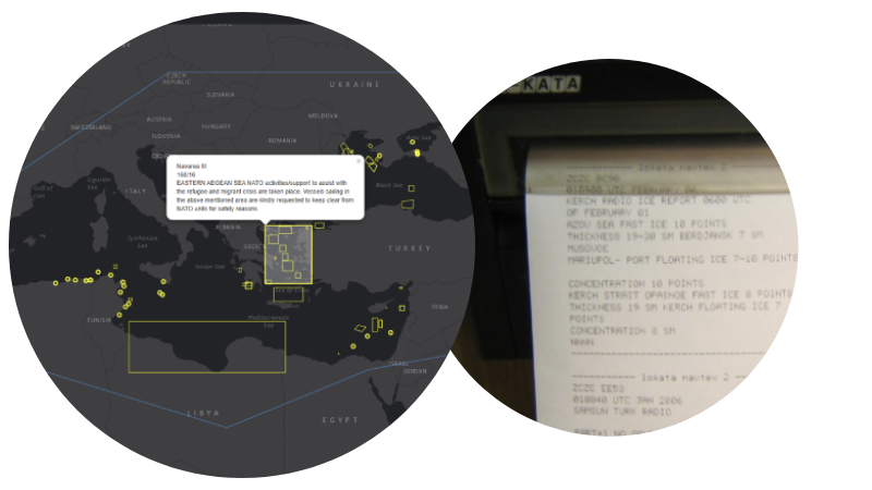
Released in 2019 as an extension to our Navarea warning app available on Android and Apple devices, Our Navarea warning API's are the one stop shop for nav area warnings, no more checking various websites for in-force and cancelled warning, use as a back up to your hardware receiver
We have advanced API's for our navarea warning dataset, perfect for integrating into your own systems and easy for developers to work with.
All warnings are checked and validated every 15 minutes so you never miss any data, all coastal warnings are included
|
NavArea
|
Year
|
Message
|
|---|---|---|
| Shandong MSA (SD) | 2025-11-13 10:17:00.377 | SD757/25 BOHAI STRAIT 0000UTC TO 1000UTC DAILY FROM 14 TO 16 NOV, SEAWATER SAMPLE COLLECT BY CHUANGXINYI IN VICINITY OF 37-31.73N 121-32.89E, 38-01.80N 120-36.00E, 38-00.00N 120-40.80E, 38-03.00N 120-43.20E, 37-58.20N 120-55.20E, 38-04.10N 120-33.13E, 37-54.00N 121-07.80E, 37-45.00N 121-09.00E, 37-48.90N 121-05.10E, 37-46.54N 121-02.48E, 37-51.19N 121-16.61E, 37-45.00N 121-18.00E, 37-34.02N 121-25.02E, 37-43.99N 121-29.63E, 37-39.07N 121-25.87E, 37-36.91N 121-28.61E AND 37-37.00N 121-24.00E. CAUTION TO AVOID. SHANDONG MSA CHINA. |
| Korea | 2025-11-18 12:17:05.423 | Geoinformation Department-3622 (2025. 11. 17.). 2. The Marine Information Institute has informed us of the maritime training plan as attached, so please inform relevant navigation and fishing vessels of this information. * Detailed locations can be checked on the navigational warning board (https://www.khoa.go.kr/nwb). Geoinformation Department End. Number - Shooting Zone Area - Date - Time - Related Chart 1 - Coastal area ~ Vicinity of Pyeongtaek·Dangjin Port within area bounded by (1) 37-00-30N,126-43-41E (2) 37-00-30N,126-44-15E (3) 37-00-15N,126-44-15E (4) 37-00-15N,126-43-41E - 11/24,25 - 13:30 ~ 15:30 - 3467 |
| Murmansk | 2025-10-30 16:00:02.11 | COASTAL WARNING WEST MURMANSK 345 CHART 12000
VARANGERFJORD
1. NAVIGATION PROHIBITED FOR ALL VESSELS FROM 01 TO 30 NOV ROUND THE CLOCK AREA 69-58.5N 031-06.0E 69-58.5N 031-12.0E 69-47.2N 030-54.6E THEN ALONG THE COASTLINE TO 69-47.4N 030-49.7E 69-47.9N 030-49.6E 2. CANCEL THIS NOTICE 01 DEC= 301000 MSK HS- |
| Murmansk | 2025-10-30 16:16:00.403 | COASTAL WARNING WEST MURMANSK 344 CHART 12000
BARENTS SEA
1. NAVAL TRAINING EXERCISES FROM 01 TO 30 NOV 24 HOURS AREA PROHIBITED FOR NAVIGATION 69-28.0N 034-47.0E 69-28.0N 035-10.5E 69-21.5N 035-10.5E 69-21.5N 034-47.0E 2. CANCEL THIS NOTICE FROM 01 DEC= 301000 MSC HS- |
| Murmansk | 2025-10-30 16:15:00.867 | COASTAL WARNING WEST MURMANSK 343 CHART 12000
EAST OF KILDIN ISLAND
1. SHIPPING PROHIBITED FOR ALL VESSELS FROM 01 TO 30 NOV 24 HOURS IN AN AREA WITH A RADIUS OF 1000 METERS FROM 69-19.1N 034-33.4E 2. CANCEL THIS NOTICE 01 DEC= 301000 MSK HS- |
| Taiwan NTM | 2025-11-17 11:16:00.143 | 181 (T) Taiwan Southeast Waters – Rocket Flight Test
Taiwan Southeast Waters Source Taiwan Space Agency, letter No. 1140003356 dated November 4, 2025. Details 1. The rocket flight test will take place in November and December 2025. 2. During the period, all vessels are prohibited from sailing the test waters. Charts affected 0313 - 0343 - 04523 - 0471B In Area (Area): Within circular area, radius 3.7 miles, centred on 22°10'30.3"N, 120°55'27.6"E Times (local): 2025-11-22 to 2025-11-23 0600–0800 (Alternative: 20251124) 2025-11-29 to 2025-12-01 0600–0800 NTM URL: https://navy.mnd.gov.tw/Files/Others/25-181(民-含附件).pdf |
| Taiwan NTM | 2025-11-06 10:51:00.833 | 178 (T) Taiwan Waters – Firing Exercise
Taiwan Waters
Source Air Force Headquarters, MND, letter No. 1140260420 dated November 4, 2025. Details 1. The live ammunition fire exercise will take place in December 2025. Regulated content is shown as attachment. 2. During the exercise period, all vessels are prohibited from sailing the exercise waters. Charts affected 0306 - 0313 - 0319 - 0331 - 0336 - 0338 - 0352 - 0356 - 04507 - 04524 - 04528 - 0471B In Area (A): Within circular area, radius 6.5 miles, centred on 23°18'18.0"N, 119°20'33.0"E Times (local): 2025-12-01 to 2025-12-05 0700–2200 2025-12-08 to 2025-12-12 0700–2200 2025-12-15 to 2025-12-19 0700–2200 2025-12-22 to 2025-12-24 0700–2200 2025-12-26 to 2025-12-26 0700–2200 2025-12-29 to 2025-12-31 0700–2200 In Area (B): 25°48'00.0"N, 120°48'00.0"E 24°52'00.0"N, 119°55'00.0"E 24°52'00.0"N, 120°23'00.0"E 25°48'00.0"N, 121°20'00.0"E Times (local): 2025-12-01 to 2025-12-05 0700–1800 2025-12-08 to 2025-12-12 0700–1800 2025-12-15 to 2025-12-19 0700–1800 2025-12-22 to 2025-12-24 0700–1800 2025-12-26 to 2025-12-26 0700–1800 2025-12-29 to 2025-12-31 0700–1800 In Area (C): 24°48'00.0"N, 119°50'00.0"E 24°10'00.0"N, 119°08'00.0"E 23°55'00.0"N, 119°27'00.0"E 24°48'00.0"N, 120°20'00.0"E Times (local): 2025-12-01 to 2025-12-05 0700–1630 2025-12-08 to 2025-12-12 0700–1630 2025-12-15 to 2025-12-19 0700–1630 2025-12-22 to 2025-12-24 0700–1630 2025-12-26 to 2025-12-26 0700–1630 2025-12-29 to 2025-12-31 0700–1630 In Area (D): 22°34'00.0"N, 118°55'00.0"E 22°21'00.0"N, 118°55'00.0"E 22°16'00.0"N, 119°37'00.0"E 22°59'00.0"N, 119°39'00.0"E Times (local): 2025-12-01 to 2025-12-05 0700–1700 2025-12-08 to 2025-12-12 0700–1700 2025-12-15 to 2025-12-19 0700–1700 2025-12-22 to 2025-12-24 0700–1700 2025-12-26 to 2025-12-26 0700–1700 2025-12-29 to 2025-12-31 0700–1700 In Area (E): 23°43'00.0"N, 122°05'00.0"E 23°00'00.0"N, 122°05'00.0"E 23°20'00.0"N, 122°38'00.0"E 23°43'00.0"N, 122°38'00.0"E Times (local): 2025-12-01 to 2025-12-05 0700–1700 2025-12-08 to 2025-12-12 0700–1700 2025-12-15 to 2025-12-19 0700–1700 2025-12-22 to 2025-12-24 0700–1700 2025-12-26 to 2025-12-26 0700–1700 2025-12-29 to 2025-12-31 0700–1700 In Area (F): Within circular area, radius 5 miles, centred on 23°29'54.0"N, 120°07'59.0"E Times (local): 2025-12-01 to 2025-12-05 0700–1800 2025-12-08 to 2025-12-12 0700–1800 2025-12-15 to 2025-12-19 0700–1800 2025-12-22 to 2025-12-24 0700–1800 2025-12-26 to 2025-12-26 0700–1800 2025-12-29 to 2025-12-31 0700–1800 In Area (G): 22°14'53.0"N, 121°40'29.0"E 21°41'53.0"N, 121°40'29.0"E 21°32'53.0"N, 122°00'29.0"E 22°26'53.0"N, 122°00'29.0"E Times (local): 2025-12-01 to 2025-12-05 0700–1300, 1400–1700 2025-12-08 to 2025-12-12 0700–1300, 1400–1700 2025-12-15 to 2025-12-19 0700–1300, 1400–1700 2025-12-22 to 2025-12-24 0700–1300, 1400–1700 2025-12-26 to 2025-12-26 0700–1300, 1400–1700 2025-12-29 to 2025-12-31 0700–1300, 1400–1700 NTM URL: https://navy.mnd.gov.tw/Files/Others/25-178(民).pdf |
| Navarea XIV | 2025-11-17 10:51:02.433 | CENTRAL PACIFIC OCEAN
1. HAZARDOUS OPERATIONS, SPACE DEBRIS DAILY FROM 19 NOV 2025 TO 25 NOV 2025 BETWEEN 2123 UTC AND 2311 UTC IN AREA BOUNDED BY: A. 14-57.00N 172-49.00W B. 13-27.00N 171-03.00W C. 00-18.00S 173-50.00W D. 00-04.00N 175-42.00W 2. CANCEL THIS MESSAGE 250011 UTC NOV 2025 |
| Navarea XIV | 2025-11-12 14:51:00.457 | PACIFIC OCEAN
1. HAZARDOUS OPERATIONS, SPACE DEBRIS DAILY FROM 17 NOV 2025 TO 23 NOV 2025 BETWEEN THE TIMES OF 0550 UTC AND 0753 UTC IN AREA BOUNDED BY: A. 10-16.00N 136-08.00W B. 10-57.00N 134-18.00W C. 01-38.00S 129-30.00W D. 02-19.00S 131-18.00W 2. CANCEL THIS MESSAGE 230900 UTC NOV 2025 |
| Navarea XIV | 2025-11-06 00:51:00.43 | VANUA LEVU - NORTH COAST
MALAU PORT
1. HYDROGRAPHIC SURVEY IN PROGRESS BY FIJI NAVY IN AREA BOUND BY: A. 16-21.67S 179-19.24E B. 16-21.46S 179-20.53E C. 16-21.30S 179-22.13E D. 16-21.52S 179-22.14E E. 16-21.70S 179-21.88E F. 16-22.00S 179-20.00E 2. WIDE BERTH REQUESTED 3. CANCEL THIS MESSAGE 060001 UTC DEC 2025 |
Start using Navareas for free by signing up. We also offer a monthly or yearly subscription to unlock more features.